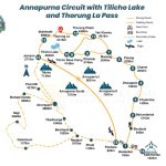
The Annapurna Circuit is a classic, long-distance trek that completely circles the Annapurna Massif. It is famous for its incredible diversity, taking you through nearly every climate and culture found in Nepal.
- The Journey: The trek starts in lush, subtropical valleys (low altitude) with rice paddies and Hindu villages. It then ascends into high alpine desert terrain (high altitude), featuring Tibetan-Buddhist culture and monasteries, culminating in the dramatic crossing of the high mountain pass.
- Unique Feature: It is usually hiked anti-clockwise. This is a safety measure because it allows for a slower, safer gain in altitude, giving your body more time to adapt before tackling the highest point.
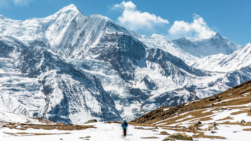
- The Landscape: You pass through two major river valleys (Marshyangdi and Kali Gandaki) and witness spectacular views of giant peaks like Annapurna, Dhaulagiri, Manaslu, and Machhapuchhre (Fishtail).
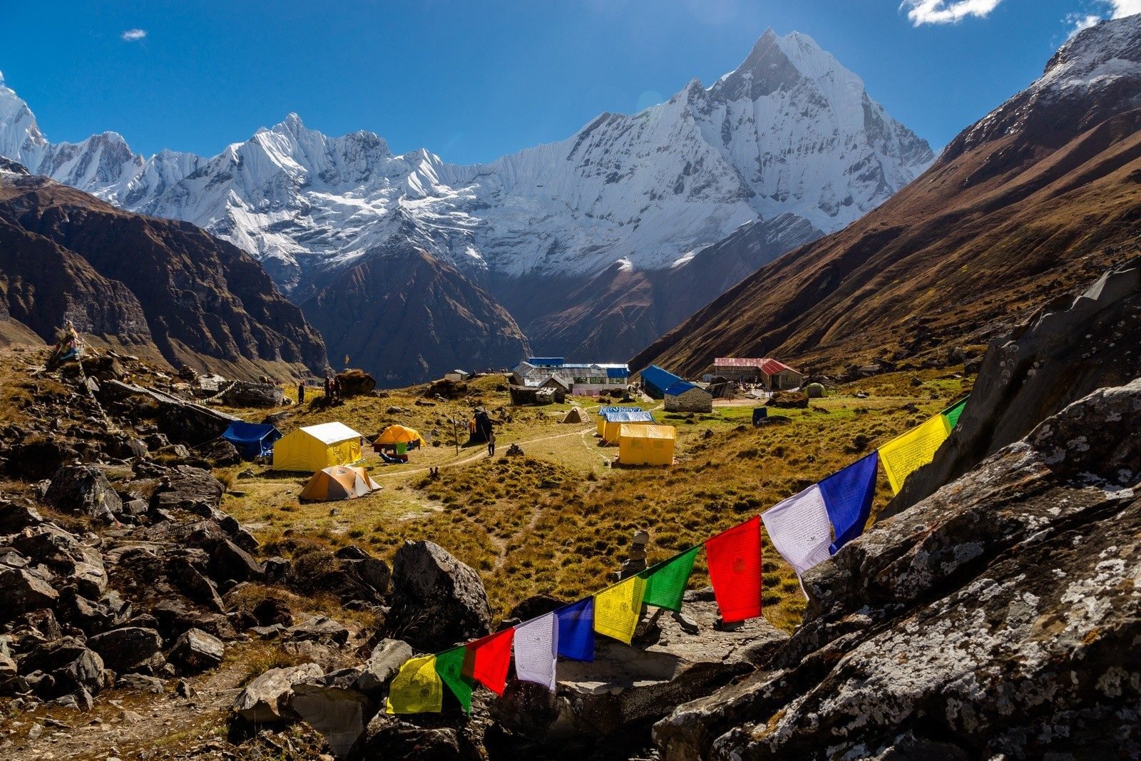
- Accommodation: The entire route is covered by Teahouses (simple lodges), so you do not need to camp.
Quick Facts
| Fact | Details |
| Duration | 12 to 21 days (varies greatly depending on how much road transport is used). A common route is 14–17 days. |
| Difficulty | Moderate to Challenging. It requires excellent physical fitness and careful acclimatization due to the high altitude. |
| Highest Point | Thorong La Pass (5,416 meters). This is the toughest day of the trek. |
| Length | Approx. 160 to 230 km (100–145 miles). |
| Best Time to Go | Autumn (September to November) and Spring (March to May) for clear skies. |
Itinerary (16 Days)
This route balances walking distance with vital acclimatization days:
| Day | From | To | Altitude (Approx.) | Activity |
| Day 1 | Kathmandu | Dharapani | 1,860m | Scenic drive (8–10 hours) to the official starting point. |
| Day 2 | Dharapani | Chame | 2,670m | Trek through forests and terraced fields. |
| Day 3 | Chame | Upper Pisang | 3,300m | Walk through pine forests; start getting first views of Annapurna II. |
| Day 4 | Upper Pisang | Manang | 3,540m | Use the upper trail via Ghyaru for better views and acclimatization. |
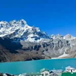
| Day 5 | Manang | Manang | 3,540m | Acclimatization Day (essential). Hike to Ice Lake or Gangapurna Lake. |
| Day 6 | Manang | Yak Kharka | 4,110m | Shorter walk, steadily gaining elevation in an arid environment. |
| Day 7 | Yak Kharka | Thorong Phedi | 4,525m | Final stop before the pass. Relax and prepare for the big day. |
| Day 8 | Thorong Phedi | Muktinath | 3,800m | Pass Day! Cross Thorong La Pass 5,416 m. Longest and hardest day. |
| Day 9 | Muktinath | Jomsom | 2,720m | Visit the sacred Muktinath temple, then descend into the windy Kali Gandaki Valley. |
| Day 10 | Jomsom | Marpha | 2,680 | Walk to the charming village of Marpha (famous for apples/apple brandy). |
| Day 11 | Marpha | Ghasa | 2,010m | Descend further through the world’s deepest gorge (Kali Gandaki). |
| Day 12 | Ghasa | Tatopani | 1,200m | Trek to Tatopani (“Hot Water”) and relax in the natural hot springs. |
| Day 13 | Tatopani | Ghorepani | 2,874m | A major uphill day, climbing back into the lush, green hills. |
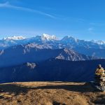
| Day 14 | Ghorepani | Tikhedhunga | 1,540m | Early morning hike to Poon Hill for sunrise views, then descend. |
| Day 15 | Tikhedhunga | Nayapul/Pokhara | 822m | Final short walk to Nayapul and drive to Pokhara. |
| Day 16 | Pokhara | Kathmandu | 1,400m | Scenic drive or flight back to Kathmandu. |
Cost Included in a Standard Package
When you book with a trekking agency, your package usually covers these essentials:
- Permits: ACAP (Annapurna Conservation Area Permit) and TIMS Card.
- Staff: Salary, insurance, meals, and lodging for an experienced, English-speaking Guide and Porters.
- Accommodation: Teahouse rooms (twin-sharing) during the trek.
- Meals: All food (Breakfast, Lunch, and Dinner) during the actual trek.
- Transport: Ground transportation from Kathmandu to the starting point (e.g., Dharapani) and from the end point (e.g., Nayapul/Jomsom) back to Pokhara/Kathmandu.
6. Cost Excluded (What You Pay Separately)
You must budget for these personal and miscellaneous expenses:
- International Flights and Nepal Entry Visa Fee.
- Travel Insurance: Mandatory coverage for medical emergencies and altitude sickness (must cover helicopter rescue).
- Drinks: Bottled water, sodas, alcohol, packaged juices, and extra tea/coffee outside of meals.
- Snacks: Energy bars, chocolates, cookies, and other personal snacks.
- Personal Expenses: Hot showers, Wi-Fi, battery charging fees on the trail (especially at high altitude), and souvenir shopping.
- Staff Tips: End-of-trip tips for your guide and porter (a major part of their income).
- Equipment: Your personal trekking gear (boots, down jacket, sleeping bag, etc.), though these can be rented.
Geographical Diversity Highlights
The Annapurna Circuit is a dynamic journey across three distinct geographical zones:
- Subtropical Lowlands (The Start): The trek begins in the low valleys (around 800 m) where the climate is warm and humid. Here, the landscape is dominated by lush, green terraced rice fields, banana trees, cascading waterfalls, and thick subtropical forests that follow the Marshyangdi River. This region is home to Gurung and Magar communities.
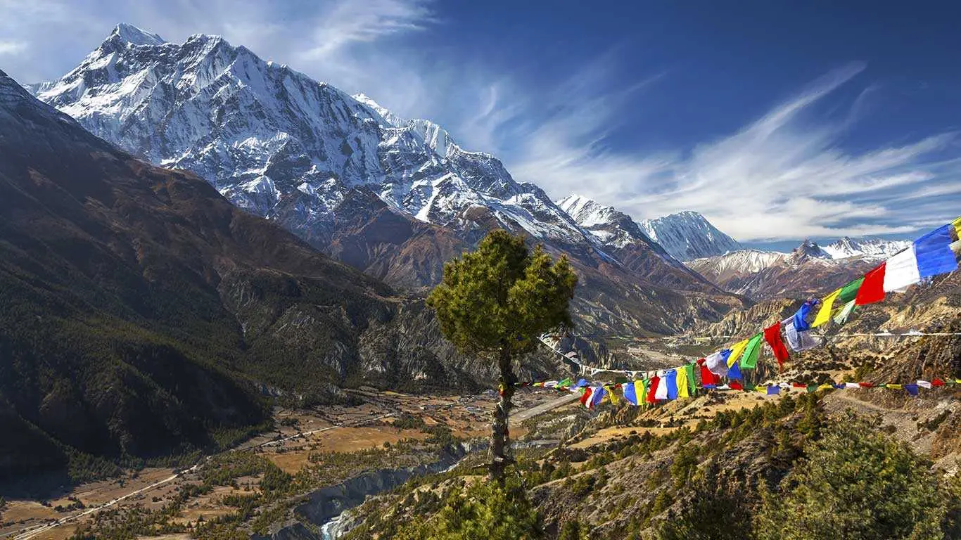
- Alpine Forests and High Valleys (The Ascent): As you climb, the environment transitions to a temperate zone, featuring dense forests of pine, fir, and vibrant rhododendrons (blooming in spring). Reaching the Manang Valley, the climate becomes noticeably cooler and the air drier, introducing the first spectacular views of the giant, snow-capped peaks like Annapurna II and Gangapurna.
- High Desert and The Deepest Gorge (The Other Side): After crossing the high Thorong La Pass (5,416 m), you descend into the rain shadow of the Annapurna range (the Mustang region). This side of the mountain is a dramatically different landscape: arid, wind-swept, and desert-like, resembling the Tibetan plateau. You then drop into the famous Kali Gandaki Gorge, the deepest gorge in the world, completing the circuit between the towering Dhaulagiri and Annapurna massifs.
Overview
The Annapurna Circuit Trek is a legendary high-altitude journey that completely circles the massive Annapurna mountain range in Central Nepal. Famous for its unmatched diversity, the trek takes you from lush subtropical Hindu villages at low altitudes, through deep river gorges, and up into arid, high-altitude Tibetan-Buddhist valleys. The main physical challenge and crowning achievement is crossing the Thorong La Pass at 5,416 meters, the highest point of the trek. Over 14 to 21 days, trekkers witness dramatic shifts in scenery, culture, and climate, enjoying spectacular, close-up views of Annapurna, Dhaulagiri, and Manaslu, making it one of the most comprehensive and rewarding trekking experiences in the world.
Highlights
- Conquer the Thorong La Pass at 5,416 meters, the ultimate high-altitude challenge and highest point of the trek.
- Experience a world-renowned diversity of landscapes, shifting from subtropical forests to arid, Tibetan-like deserts.
- Walk through the Kali Gandaki Gorge, the world's deepest gorge, flanked by the 8,000-meter peaks of Annapurna and Dhaulagiri.
- Engage in Tibetan-Buddhist culture in the ancient villages of the Manang Valley, surrounded by spectacular mountain views.
- Visit Muktinath Temple, a sacred pilgrimage site for both Hindus and Buddhists, marking the end of the high-mountain journey.